Navigating by Mongolian GPS: The Ger Positioning System
Mongolia is a country with very few paved roads, as well as very few official roads in general. While this is not a problem for me due to the fact that I will be traveling on horseback, it does make navigation somewhat difficult, as there’s not really anything to follow along a map.
There seem to be two camps of thought for navigating Mongolia: use a western GPS system with pre-loaded topographical maps or use the Mongolian “GPS”.
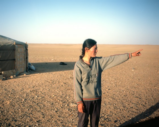
The Mongolian “GPS” is not a gadget but instead is typically a gesture. When traveling in Mongolia, many have been successful at using what has jokingly become referred to as the “Ger Positioning System”, and many claim that it is just as reliable, if not moreso, than a computerized GPS, and most Mongolians prefer to use this system.
How to use the Ger Positioning System:
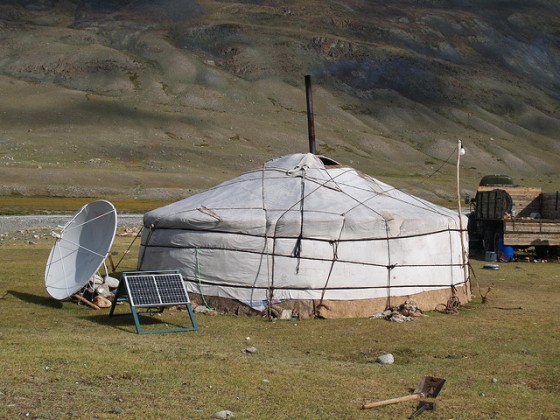
- Locate the nearest ger (yurt). Find a resident while avoiding the ferocious guard dogs typically skulking about.
- Ask where the next ger in the general direction of your destination is.
- Follow the direction of the nomad’s pointed hand until you come to another ger.
- Repeat.
That’s it! Mongolian nomads are intimately familiar with the landscape around them, and typically have a good sense of where their neighbors are. It’s not 100% reliable, but in a country where no 100% accurate map exists, it’s a pretty good option for those who want to find their way around Mongolia without a guide (like myself). Plus, each time you stop you will likely be offered food and water. If the family has a solar or wind power set up, you may be allowed to recharge a device (such as a satellite phone, camera, etc) for a little while.
 If you do use Mongolian GPS in your travels, make sure to carry some sort of gift to give out. Cigarettes, candy, or even a polaroid will work. You should also carry a compass that is capable of marking down a heading, so that you can make sure you don’t wander off track. If you have a western GPS, you can also use that to plot your heading. If you lose track of what direction you are pointed, look for other gers (even if no one is around) because ger doors always face south and you can use that knowledge to re-align yourself. If you can’t find any, look for the telltale circular marks of gers that have moved on, and see if you can determine where the door was via worn away patches of grass.
The Ger Positioning System seems to be the preferred method of navigation for teams in the Mongol Rally, and I have read accounts of many other travelers using this method, either by itself or in conjunction with more modern navigation aids. Mongolians have been traveling this way for centuries (millennia, more likely), and I am planning on using this method in the more populated areas of the country. The more I read about people successfully using this method from getting place to place, the more confidence I have in myself that I should be able to do it as well. A few land navigation lessons wouldn’t hurt, though. ;)
[Photos by Bart Pogoda and Kit Seeborg]


Twitter Trackbacks…
…
A couple of comments: generally, gers are oriented with the door facing south. Also, the sun beats so hard on one side of a slope that trees will generally only grow on the north side (this holds pretty well in central to northern Mongolia at least). You can often see a very clear line along any hill that delineates a south-north line.
I’ve spent a couple of months riding around Mongolia on horseback, and would be happy to share some of my experiences. Email if you are interested.
Yep, I mention the south-facing doors in the entry. I figure that it makes even unattended gers something of a navigation aid.
I would definitely be interested in picking your brain re: Mongolia. I’ll send you an email tomorrow.